Ghost Towns in the Greater Bancroft Area- by Jody (Didier) Yantha
Bancroft was one of the larger villages in North Hastings. Settled in the mid 1800s, it consisted primarily of flour, saw, woolen, and shingle mills in its early days. At the turn of the century the North Hastings region was experiencing unprecedented prosperity and its population was at a peak.
The Barry’s Bay area of Renfrew County (Sherwood Township), was first settled over a hundred years ago, along with other communities on the Opeongo Line. The town also served as a standby base for the Canadian Military during the war years.
The area is dotted with many ghost towns, which make a fun day trip… this blog will highlight a few. Why not order a picnic, boxed-lunch from one of our wonderful local eateries and make a day of it?
Addington (Perry) Road
Get there: Highway 41, from the Clare River south of Highway 7 to the Denbigh area, parallels much of the old road.
Commonly called the Perry Road, after the Perry brothers who built it, the Addington Colonization Road started at the Clare River in Lennox and Addington County. It wound its way northward, skirting Mazinaw Lake, to eventually link with the Ottawa and Opeongo Road through Renfrew County. Provincial Land Surveyor A. B. Perry won the contract to build the road and 45 miles were completed by 1856.
First the road route was blazed, to guide the work crew through the wilderness. Next, trees along the way were hacked down, with large stumps often left to rot. Little grading was done and travelers had to wind their way around the large stumps and hazardous rocks. Swampy areas were laid with “corduroy”—logs spread across the road. Travel over these areas was a bone-jarring experience.
Culverts were installed to facilitate drainage and bridges were constructed over creeks and rivers. Frequent fires destroyed the bridges and travelling the road was tiring and hazardous. It was much easier to get around by horse and sleigh during the winter months, when snow and ice covered the road. A. B. Perry completed the road to the Madawaska River but bridges over the Madawaska were destroyed regularly by the large log jams from river drives.
Finally, Ebenezer Perry, A. B.’s brother, completed the Addington Road to the Ottawa and Opeongo Road. Ebenezer was the land agent for the Addington Road. He dispensed location tickets to the free land grant settlers who took up lots along the way. By 1858, some 160 lots were occupied, with more than 100 others settled the following year. It was a tough life for the pioneers, but some of them stayed to enrich the region we call Mazinaw Country.
Balaclava (Renfrew County)
Get there: Turn North from Dacre (highway 132) onto highway 513.
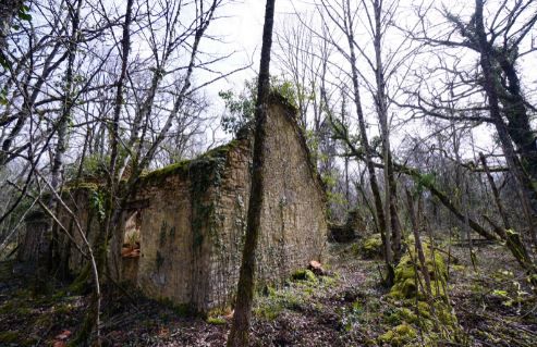
You’ll find a row of ramshackle buildings with sagging roofs, huddled along a narrow road.
The remains of Balaclava include an old water powered sawmill, one of the last to operate in Ontario. If you look closely, you can still see pieces of machinery and wagon wheels inside the building.
The first sawmill was built in 1855 and purchased by the Richards family in 1868. Interestingly, the Richards family was taken to court in 1903, on an early piece of anti-pollution legislation. Apparently, the Richards had been using the stream as a disposal unit for all their sawdust. The stream was becoming clogged and another mill, further downstream, complained. The Richards lost the court battle and shortly after that, added the huge burner, which still stands today.
Much of the original mill was destroyed by fire in 1936 but was quickly rebuilt and continued to operate for only a few years after it was sold to Donald Dick in 1957 and ceased operations when the surrounding timber supply became depleted.
Although Balaclava had been a busy industrial and farming centre throughout the latter part of the 19th century, it was by-passed by the railways- that… combined with failing farms and dwindling lumber supplies was the town’s demise. The mill continued to operate on waterpower until 1967.
There may be one occupied house in Balaclava. Well kept, with sky blue aluminum siding, it usually features a large For Sale sign in front, presenting a humorous contrast to the buildings across from it.
Bannockburn
Get there: about 15 miles north of Madoc on Highway 62.
Gold was first discovered at Bannockburn around 1878.A small deposit, it was known as Bannockburn Gold Mine and run by locals for several years, with little success.
The mine operated as a commercial venture from 1894-1898.Operations included a 10 stamp mill and mercury amalgamation process for recovery of the gold.The workings consisted of several shafts, small pits and an open cut trench.
The mine never operated at a profit, due to the irregular nature of the deposit.It lay abandoned until 1982, when it was acquired by a prospector.Most of the workings have fallen in or are now obscured by forest.
Balvenie (Renfrew County)
Get There: about 8km east of Griffith on HWY 41 lies a road named Marchand-Lacourse Rd. Turn right and continue to the fork. (Note: you will likely need a 4×4 or walk in from there on)
A small settlement established itself here in the late 1880’s and added a post office in 1891- it closed in 1940.
Blairton
Get there: Follow Highway 7, west of Marmora- 7 kilometers to the Blairton Road. The former town site is two kilometers to the north.
An iron manufacturing town of the mid 1850s on the shores of Crowe Lake, a location accessible only by water as roads were nearly unusable. The railroad eventually came to Blairton in 1866 that made the mining operation more profitable. The mine was an open pit mine close to the lake and the town located to the rear. With the railroad, the town began to grow and soon had a population of around 500 inhabitants. The town prospered for about ten years when water became its worst enemy. Ice floes tore away the railroad trestle. Water began to seep into the mine.
At one time, the town had boarding houses, stores and about forty houses for miners with families.
Brent (Algonquin Park, Nipissing District)
Get there: A few kilometres West of Deux Riviere on Hwy 17 is the Brent Road, follow this dirt road for 63 km until you hit Brent.
There are still cottages on the road, at least until their leases expires in 2017- there are also rail-beds, some foundations, an abandoned hotel, Ranger Station and a cemetery.
Brent was a divisional point on The Canadian Northern Railway, between Pembroke and Capreol. Built in 1915, the facilities included a round house, water tanks, coal chute, maintenance sheds, shops, and station. Brent also boasted a general store, school, church and post office (1928-78). From 1921-32 The Brent Lumber Co, operated a sawmill half a mile west of the settlement. The advent of diesel rendered the divisional point useless by the 1960’s and it closed in the early 70’s. Brent at that time counted 160 residents. In 1978 the government refused to maintain the long dirt road, and ordered the residents put of the park (for the winter at least). The rails were taken up in 1996 and the station and numerous buildings have since disappeared.
Brinklow (Limerick Township)
Get there: At the corner of Highways 62 and 620.
Also known as Brinklow Station on the Central Ontario Railway. There is an old house on the corner, it is currently being updated.
Brudenell
Get there: Around the intersection of Foymount Rd 512 and Opeongo Rd
Once the busiest community on the old development road, Brudenell boasted some 200 residents in the latter 1800s.There are still 36 registered parish families, most of whom are descendents from its 1850s town founders. At one time, Brudenell had a racetrack, blacksmith and 3 hotels that served liquor- the town fast gained a reputation. They say a Brudenell Saturday night was a thing to behold and then Sunday mornings at “Our Lady of Angels” church was a sorry sight, indeed.
As you enter Brudenell, the concrete foundation on your left is all that remains of Bill Costello’s hotel- it later became the office of the Brudenell and Lyndoch Telephone company- and the private home next door (at one time the town hall) still retains some of its original grandeur with its large veranda and gingerbread trim. When this establishment was operated by Cooey Costello, it was known locally as the “sin bin” and its main salon featured a grand piano.
There was a daily stage service to Eganville, Rockingham and Combermere, from Brudenell in the late 1800s.The decline occurred when Primer Minister Laurier routed JR Booth’s railroad through Killaloe instead of the Opeongo line, in 1893.
Al Capone had a large log cottage on nearby LetterKenny Road… a perfect getaway in the lush Ontario wildnerness.
Burgess
Get There: New Carlow Rd (which runs south east off Hwy 62) a few kilometers east of Maynooth.
Ore crushers peer through the birch trees, while across the road stand the log remains of a storage building. There is evidence of former mining and milling operations, throughout the area.
Once a thriving village of about 300, employed primarily in the corundum mine, the town was booming until a synthetic version of corundum, “Carborundum”, was invented.
Castleford
Near Renfrew
Off the Opeongo Line, around Farrell’s Landing. From River Rd 1, turn right onto Thomson Rd and travel 1.4 km (0.8mi) to the driveway beyond the spruce plantation on your right. Walk up to the next driveway on your right to access the First Chute via a tree-lined lane.
West of the bridge on the right, a plaque commemorates Lt Christopher James Bell, a veteran of the War of 1812, who settled on the Bonnechere in 1829. In the time when rivers were the highways of trade and commerce, those making the trek up the Bonnechere River from the mighty Ottawa used Farrell’s Landing (a few kilometres up-river) and the village of Castleford as jumping-off points to the interior. Timber barons, loggers, teamsters, and the pioneer squatters who established farms up-river to supply the logging camps disembarked here.
Cheddar (Haliburton)
Get there: Hwy. 118 west from Tory Hill to Cheddar Rd and head south to the boarding house.
Nobody lives here and the village has been swallowed up by the forest. The village was located in the former Cardiff Township (once the northern part of Peterborough County but now in Haliburton County) The old mine 1 km south of Cheddar does not allow trespassing but the old town site east of the boarding house, through the forest, still has the remnants of old buildings.
They say that Cheddar is a ghost town extraordinaire. A trip to its present location will baffle the mind at its illustrious past. The ghost town has been literally reclaimed by the forest and only one building remains. Cheddar began in 1871 when Benjamin Woods opened a store and post office along the windy and new Burleigh Road (a colonization road). It was called Wood’s Corners. Mr. Woods offered “entertainment to the travelling public”. Soon after came the hotel, a blacksmith, sawmills, 2 churches, a school and a second general store (owned by A. Southwood in 1890). Mr. Southwood got the new postmaster contract and instantly changed the name of the prospering settlement to Cheddar after a town in England. By the 20th century uranium was found nearby. The Cheddar Mine opened in 1932. By 1942 the mine was abandoned and soon the town began to fade in importance. In the winter months to keep active the local men formed a hockey team that would play local larger towns like Wilberforce. A fire tower was located south of Cheddar past the mine at Hook Mountain. Built in 1931, its towerman protected the local forests by an early detection of forest fire from the tower’s cupola. The farm soils had become depleted by the 1950’s. New roads were built and paved to welcome the new cottage boom in Haliburton. The old windy gravel trails that were the Burleigh and Monck Rds. were paved and straightened to bypass Cheddar. Suddenly the once strategic junction was left behind. The forest has reclaimed the entire town site and mine site. All that remains is the old boarding house, a cistern and fragments of the Cardiff fire tower.
Corbyville
Get there: on the bank of the Moira River– Corbyville is north of Belleville. Take Canifton road until it divides.
Mr. Henry Corby immigrated to Canada. Mr. Corby had been a baker back in England and when he arrived in Belleville in 1832, set up a small shop. After serving in the Rebellion of 1837 he bought a St. Lawrence steamer named the “Queen” which he operated for four years.
It was customary for farmers to set aside a portion of their inferior grain to be made into whisky, and as Henry Corby was already making whisky for the locals, it’s no wonder that he became interested in the distilling process. In 1857, Corby built a dam and established a grist-mill on the bank of the Moira River. In 1859 he built a distillery which became more important than the mill.
Ten years after building his first mill, Henry decided to try his hand at politics and was elected mayor in 1867. The following year he served as a member of the Provincial Parliament for the Conservatives.
Henry died on October 25, 1881 at which time his son, Harry, took over the business. Harry began to sell the whisky by the bottle rather than the barrel, seeing it a better business opportunity. In 1905 the company was named the H. Corby Distillery.
Hiram Walker bought the operation and added a number of new facilities. A short distance from the town, the Walker Company built new vats and company offices and the name Hiram Walker became known the world over. For nearly 70 years the Walker Distillery flourished. In 1991, the operations were closed.
On Sunday April 5, 2009 the old Corby Distillery burned down- arson was suspected.Only one building and the silo remains on the site.
A bookstore now occupies Henry’s old bakery and grocery store.
Cordova (Peterborough County)
Get there: 32 mi/51 km NW of Belleville
“the hamlet with the heart of gold,”
While a number of early buildings remain occupied, a number of other buildings are gone and Cordova stands as a ghost of the minefields. Around the turn of the beginning of the 1900s, Cordova was one of Ontario’s leading gold producers. After the gold rush to the Highlands of Hastings began in the year 1866, any of the deposits proved difficult to work or outright fraudulent.The local bubble burst and the mining camps turned into ghost towns.
During the 1890s, improved technology prompted the reopening of some of the more important mines located near Cordova. Between 1892 and 1917, two of the larger mines produced a combined 23,000 ounces of gold. By the 1940s all mining in the Cordova area had stopped and the mines closed.
Craigmont
Get there: located several kilometres south of Combermere, Ontario, in the woodsy hill country of Raglan and Carlow Townships.
Craigmont was a mining town.Its ore, Corundum, was the hardest mineral- save for the diamond. Corundum was used as an industrial abrasive. The Craigmont deposit was discovered in 1876, but it was not until 1900 that mining operations began by the Canada Corundum Company. The town had a population of 400 consisting of both a company town and a private town. Following the 1913 flash fire that destroyed the mill, Craigmont fell into decline and by 1921, all that was left were the remains of the huge smelter and its foundations.
Dartmoor (Victoria County)
Get there: Take the old Monck Rd east from Hwy 12 past Sebright to Dalrymple Rd.
Dartmoor has certainly vanished from modern maps, but at one time was a thriving hamlet with a schoolhouse and a post office. Some of the old barns remain as well as an original log cabin/farmstead and the schoolhouse.
Located on the Monck Rd at Lake Dalrymple Rd. in the former Township of Dalton, City of Kawartha Lakes-a former municipality located in the northwest corner of the former County of Victoria, now the City of Kawartha Lakes.
The town was named after Dr. John Dalton (1766-1844), an English scientist who had a lot to do with the beginnings of atomic theory. Dalton has an extensive history in logging and colonization along the Old Monck Colonization Road.
Villages in the Township include old logging/farming communities from the 1800s. These include: Sadowa, Sebright, and the ghost towns of Uphill (also on Monck Rd.), Ragged Rapids and of course, Dartmoor. All had been rural post offices. Settlers included the Thompsons, Gardiners, and Montgomery’s and were mainly of Scottish/Irish Presbyterian backgrounds. Back then, one of the most colourful figures of the municipal history of the township was Joseph Thompson who was reeve for a quarter of a century. Thompson was a great hunter, there are many legends that speak of his prowess in the wilderness.
Doyle’s Corners
If you are looking for Doyle’s Corners, you should know that it was subsequently called Tara, then Oxenden and finally Maynooth in 1863 after a town in County Kildare, Ireland.
Eldorado
Get There: Hwy 62 North of Madoc, approximately 21 kilometers. Turn left on Center Millbridge Road.
The first gold rush in Ontario occurred in 1866 when word of fabulous strikes came out of the wilderness of Hastings County. Prospectors, speculators and miners from across Canada poured into the area with the hope of finding their fortune. Within a few weeks, there were hotels, bars, brothels, boarding houses, mercantile stores and others that numbered more than eighty buildings. In the time it took to become a boomtown, Eldorado became a ghost town when many of the claims proved to be fraudulent.
Enterprise: The Township of Stone Mills (established on January 1, 1998 by the amalgamation of the former Township of Camden East, Township of Sheffield and Village of Newburgh)
See also “Newburgh”
Getting there: Greater Napanee/Lennox Addington
The township covers 71,064 or 68,833 hectares and is centrally located and share boarders with; Addington Highlands, Tweed, South Frontenac, Loyalist, Deseronto and Greater Napanee
The area is home to a number of ghost towns, throughout Camden East, Colebrook, Enterprise, Newburgh, Tamworth/Erinsville, and Yarker- some built upon and around the Canadian Shield, the Limestone Plain and the Salmon River Valley.
The Newburgh/Centreville area might best be described as a series of hamlet – sized communities in rural settings. “Rogues’ Hollow”, Newburgh’s original name and “Whalen’s Corners”, Centreville’s first designation, and the numerous small centres in the former Camden East Township, all had a very meteoric rise and fall.This region in the present Stone Mills Township, so named because of the many old limestone structures in the area, has gone from booming mill and small industry towns to the present ‘bedroom’ communities for Napanee, Kingston and to some extent Belleville.
At Centreville, the old log schoolhouse still stands about two km west of the hamlet’s main intersection.
Esmonde
Get there: turn onto Opeongo Rd from Hwy 41-About 1.5km (0.9mi) beyond the roadside biway, look for the Opeongo Oasis on the right side of the road.
Early settlers, shantymen and travellers often stopped here on their journey up the line to quench their thirst. Legend has it that since these stops sometimes resulted in heated discussion and bloody conflict, the creek would at times run red with blood. Others contend that the water was coloured by the red wine which was split during the common practice of diluting to make the bottle last longer.
St Joseph’s Roman Catholic Church, built in 1890, marks the remains of the hamlet of Esmonde. From here the road skirts the base of the Opeongo Hills along the southern edge of the Bonnechere Valley.
St. Joseph-the-worker, with sleeves rolled up and wearing a careworn expression, appears to be standing guard over Esmonde’s Catholic Church. In fact, after much debate, it faces westward down the Opeongo Road. During the statue’s commission — thought to be in the 1980s — it was debated as to the direction it would face since St. Joseph’s parish includes people from both Dacre, to the southeast, and Griffith, to the southwest. To split the difference, St. Joseph would have to face south. In the end, the community did not want the sainted statue to face southward into the bush where, in the words of a local, there was nothing Esmonde is just one of several communities built along the historic line. It boasted a school and Catholic Church, and for a while, a post office. But, once the land was farmed out the settlers moved on. St. Joseph’s Catholic Church continues to offer mass to this day
Ferguslea
Get there: From Renfrew, head up the Opeongo Line by travelling west via Hwy 132 to the Ferguslea bypass.
The biway into Ferguslea follows the route of the original Opeongo Line past several original log homes and rustic wood fences reminiscent of early Canada. The Kingston and Pembroke Railway (known as the Kick’n Push) came through in 1884, and for years thereafter passengers would disembark and overnight at the once-bustling Opeongo Hotel.
Foymount
Get there: ascend northwest along Opeongo Rd to the intersection of Foymount Rd 512. Turn left and proceed for a short distance to Foymount.
Foymount might be it considered a modern ghost town of sorts.Constructed during the “cold war” as a radar base and part of the NORAD system of hostile aircraft detection, the town sits atop the highest point of land in eastern Ontario. Intercontinental ballistic missiles made the base obsolete and the town closed down. Recently, however, a few inhabitants have made Foymount home- but there is still much to see of the remains of the once bustling military establishment.
Frontenac Road
A route for the Frontenac Colonization Road was surveyed by Provincial Land Surveyor Thomas Gibbs in 1852 and 1853. The road was constructed under the supervision of Warren Godfrey. It began in Hinchinbrooke Township and was completed through Olden and Clarendon Townships and into Miller to the Mississippi Road junction by 1862. The community of Playfair Corner grew up at the intersection. The Frontenac Road shared the same roadbed as the Mississippi Road as far as Johnston Corner, to the northwest, but the section was abandoned early in favour of a route through better farmland. The road was extended to the Madawaska River before the end of the decade. Most of the free land grant settlers who took up lots along the Frontenac Road were unsuccessful in their bids to establish self-sustaining farms in the region. One by one, they pulled up stakes and left, beaten by the harsh climate and inadequate soil conditions. Much of the Frontenac Road fell into disuse, but some of it was incorporated into township and county roads. Mountain Grove, Coxvale, Ardoch and Plevna are communities that developed along the Frontenac Road.
Furnace Falls Haliburton
Get there: From Highway 503 take the exit to White Boundary Road. Continue on this road for 1.2 kilometers. The former town site is situated in an open field with a log building on the north side. According to modern maps this is town centre, but is actually the southern section of the village. The northern section of the village (on the former IB&OR railway line) is now a trail. To the south of the abandoned barn and log cabin visible from County Rd. 503 (just before the picnic area) there is a creek where the rail trail crosses. This is about where the flag stop was located for Furnace Falls.
Today, all that remains of Furnace Falls are the falls themselves and sporadic buildings and old log barns.
First settled in 1874, Furnace Falls was built to accomodate workers at the Snowdown Iron Mine (in Snowdon Township) at Lot 20 Concession 1.
By 1887 a siding and flag station was built on the Irondale, Bancroft and Ottawa Railway (IB&OR) and was situated between the communities of Irondale and Howland Station where Furnace Falls sprang up at mile 4.9 on the railway line.
J.C. Parry opened a saw and shingle mill at Lot 18 Concession 1 after iron ore was found here too. He also built a store in 1883- it served as the settlement’s post office. There was also a smelting works, workshops, 5 homes and other buildings in the hamlet. Later there was a Furnace Falls school called USS #7.
The hamlet never had a population higher than 50.
Gelert (Haliburton)
Get there:Haliburton County, south of Minden where the Gelert Rd. and Sedgwick Rds. meet.
There are 2 churches, school, 2 stores, old homes, town hall still standing.
Gelert began as a sawmill village and at times had been called Little Ireland, Snowdonville and Minden Station. First settled in 1860, Gelert was thriving in the late 1800s- especially after the 1878 of the Victoria Railway.
By the 1890s, Gelert had a post office, 2 general stores (both still standing), a shingle mill, sawmill, carpet mill, blacksmith, hotel, carpenter, shoemaker, wagon maker, churches and a school.
Depleting farm soils (a common problem on the Canadian Shield) and losses of timber stands in forest fires are blamed for sending the village into decline.The post office closed in 1969 and CN removed the rail lines in 1980.
The cemetery at the east side of town is the resting place of a number of early Finnish settlers.
Glanmire
Get there: 11 km north of Millbridge on the Old Hastings Rd.
All that remains of this community is the cemetery and the cement steps leading up to a monument at the site that was once St. Margaret’s Anglican Church (1887), 3 derelict wood structures, cedar fencing and forest.
First known as Beaver Creek and then Jelly’s Rapids, after settler Andrew Jelly- the first reeve of Tudor township. The community once boasted a school, church, post office and a few dwellings.When the post office opened, the new name Glanmire replaced the old.
In the early days, a UE Loyalist, Isaac Stymers, carriedf the mail on foot from Glanmire to Bancroft.Although most of the buildings are gone, just north of the cement bridge crossing Beaver Creek, the cemetery headstones in the St. Margaret’s churchyard remain. As with much of the land along the colonization road, the land was quite infertile and the town’s days were numbered from the start. The post office closed in 1939. The church lasted a bit longer until the 1960’s when it was demolished. Havergal
Get there: Hwy 28 East from Bancroft 25.6 km to McArthur Mills, then just a few hundred meters east of McArthur Mills turn left (north) on Boulter Road. Take Boulter Road north about 12 km to either Havergal or Haas/9th Line.
Silgrey, a rustic four-season hunting and fishing camp featuring some of the best fishing in Ontario is located on the site of the original Conroy Brothers farmstead.
Here, at the Conroy’s Farm a post office was established in 1880 – the name was changed to Havergal in 1886.
Silgrey has several rental cabins, at the waters edge, overlooking the Conroy Rapids on the York River at the Conroy Marsh. There are also several river view or forested campsites available.
Hazzard’s Corners
Getting There: Just a few miles from Queensboro in Madoc Twp- Directly north from Belleville 20 minutes on Hwy 62. 10 minutes south of Madoc (Hwy 7) on Hwy 62. 11700 east side of the Hwy. 1 mile north of Ivanhoe.
Hickey Settlement
Get there: North of Bancroft, Ontario half way between Birds Creek and Maynooth off of Highway 62 are Hickey’s Road East and West.The west road leads back onto the land of the original Hickey Settlement and on up Hickey’s hill to where the old homestead and farms were.
Primarily settled by the Hickey family from Ireland.Stone fences run through the forests, reminding us of the torturous labour the pioneer farmers undertook.
Hybla
Get there: Hwy. 62 north from Bancroft about 11 km to the Hybla Road (on the right). Follow the road east about 2 km and you come to the Hybla Gospel Tabernacle, a small, insulbrick building almost hidden by trees and bushes, but close to the road on it’s north side. The small train station is now the residence of the Woodcox family.
(if you continue on the Hybla Road another 3.5 km and you come to a T in the road, turn left 3 km down the road, on the north side the Zion United Church stands.)
Hybla’s main street now consists of three original buildings, a store, now a house, a dwelling and the abandoned Hybla Gospel Tabernacle.
The railroad arrived in 1907, when Hybla was a quiet farming community and soon the settlement grew to include a small station, by the tracks.On the main street were two stores, boarding houses and churches. A blacksmith shop and a sawmill made up Hybla’s other industries. From the feldspar mine high in the hills beyond, wagons brought the ore down a winding road piling their load beside the small station. When the railroads switched from coal to diesel, the station and boarding house were no longer needed.
Kenneway (Haliburton)
Get there:Surrounded by forest and lakes, the village was relatively isolated in the area, approximately 10 km away from Wilberforce, a larger town to the South East.
North of Harcourt in Haliburton just south of Algonquin Park, this settlement village was located near the modern town of Harcourt, Harcourt Township, Haliburton County, Ontario. It began around 1860 and was abandoned around the 1930’s. Primarily a farming settlement, Kennaway also supported a schoolhouse, a few mills, a livery stable, a post office and a hotel. Kennaway created its farms out of the piney soil of the Canadian Shield..
Kiosk (Algonquin Park- Nippissing)
Get there:25 km west of Mattawa, Highway 630, turn left, and follow about 35Km, to Kioask.
Originally, Kiosk was simply a mill, built by the Staniforth Lumber Co. in 1936. The small settlement clustered nearby and by 1948 included about 175 residents, a catholic church, a separate school, company store, post office, company offices, a bunkhouse and 15 dwellings. By 1960 it was a bustling village of 80 homes and nearly 600 residents.
The mill burnt down in 1973 and the government ordered all residents to vacate by 1996. By 1990 the place was empty and Kiosk was little more than an Algonquin Park info centre
Khartum (Griffith Twp, Renfrew County)
Get there: A sign announces Khartum about 6km East of Griffith on HWY 41.
In Khartum, you will find the foundations of a burned-out service station and (near the creek) the remains of an old lumber dam.
The settlement, at one time, included a sawmill, store/post office, bunkhouse and a few homes. The post office opened in 1903 with the name Lett, and was changed to Khartum in 1908
Malone: Marmora and Lake Township
Get there: North Marmora- 401 at Belleville, exit 538(W.L. Road) and drive north on Wallbridge Loyalist to Hwy 14; northwest on 14 to Marmora. From Toronto, exit 436 (Newcastle) and drive on Hwy 115 north to Peterborough. Take Hwy 7 to Marmora. Corner Hwy 7 & Victoria
First known as Powells Mills, the village took the name Malone in 1863 when the first post office opened. Also a mining town, Malone was smaller than Cordova but had more mines operating but for a shorter period of time. By the turn of the century, the mines were no longer productive and were closed.
Another remaining legacy of iron mining around this region; the Marmora Open Pit Mine, is a man-made wonder-lake, seventy five acres in area, six hundred and thirty five feet deep, filled with four hundred feet deep of clear blue spring water that is steadily rising to the top.
Marlbank
Get there: Marlbank is located in Hungerford Township in the second concession-in Tweed, Ontario, Canada, a few kilometers west of Highway 41
Originally called Allen’s Mills, after Dr. James Allen, the first settler- a graduate of Edinburgh University who came to Canada shortly after graduation and settled in Conway, Ontario about 1839.
From there he moved to Napanee, then known as Appanea, where he practiced medicine and owned a drug store. A sawmill was practically a necessity in a settlement at that time, and one was built along the stream that flowed through the valley. More settlers came and soon the hamlet became self-sufficient.
Allen’s sawmill cut the lumber for the buildings that were starting to sprout up in the valley. The mill operated by using a water wheel, which operated with swinging buckets. “The creek poured from a canal and dam down a fifty foot fall to fill a wheel bucket. The weight of a full bucket pulled the next bucket to the filling station level as the wheel revolved. By shaft and pulley a rope was harnessed to the water wheel to saw the sturdy logs into boards.”
More settlers came and soon the hamlet became self-sufficient. Many necessities such as crude farming implements and the repairing of wagons and sleighs were in constant demand. There was also an Irish weaver who wove flannel, and a village tailor who fashioned clothes from this flannel.
The population in the valley grew steadily and it became necessary to build a school. The first school was built along the road that led to Tamworth . Around 1870 a larger building was erected on what became Queen Street after the first school became too small for the number of pupils. This first school was then used as a house and was situated near the railway station. It was still standing when the second school had burned down and was finally dismantled about fifty years ago.
The inhabitants petitioned the government for a mail service and post office. Dr. Allen was asked to select a name for the office and, because of the nature of the soil in the valley, Dr. Allen chose the name of Marlbank. The inland sea of the early ages had dried and left millions of tiny animals called crustaceans. Their bodies changed to white dust and were called marl, hence, the name of Marlbank.
The post office was located at the northern end of the village for many years. In the 1920’s it was moved to the center of the village and remained there from thirty-two years. It was then moved to the top of the hill on the main street. In 1974 it was again moved a few doors down the street to the home of Harold Tuepah. It is now housed in the only general store left in Marlbank.
In 1904, a fire erupted on the site of the Marlbank Phoenix but the building was rebuilt in 1905, and was known as The Stinson House.
In 1907 the building and ownership changed hands to Mr. William O’Keefe, who re-named the pub after himself, calling it the O’Keefe House, shortened and regularly referred to as the “O.K. House”. The business held fast to this name through several years, and owners until 1938 when Sam Schell dubbed the building “The Marlbank House”. After a fire destroyed most of the building again in 1994, the tavern’s name changed once more, quite fittingly, to “the Marlbank Phoenix Tavern”.
When the first rural postal service was introduced about 1914, Henry Allen became the first mail deliverer. Henry would bicycle twenty miles a day to deliver the mail.
Marlbank is the home of the hardest underwater cement in the world that built the Suez Canal. Dr. Allen had been aware of the large deposits of marl in the vicinity and hoped that they might be used for crockery some day… but nothing very much was done with the deposits until the unusual soil was discovered to be excellent in the making of cement.
There is some discrepancy as to who was the first company to move into Marlbank to start up the cement works. Some claim that the first company in Marlbank was the Canada ‘s Cement Company, which was formed in 1891, and in 1892 the cement plant was erected- others say that it was the English Portland Cement Company Works.
On November 10, 1898, R.T. Hoppner and Company, mineral dealers of Montreal, bought stock in the Marlbank works and, in December 1898, a new, larger building was near completion. In the spring of 1899 the cement works opened, slated to run day and night, including Sunday.
On 24 May 1900, The Tweed News carried the heading “Cement Companies Amalgamate.” The manufacturers of the Portland Cement Company had consolidated their interests.”
Many died during the plant’s period of operation and one man lost an arm. The plant was also plagued with many fires- September 22, 19 00 the cement works was almost totally destroyed by fire- August 12, 1903, another fire gutted the “clinker grinding room” and November 8, 1903, there was another damaging fire, in the same room.
Marlbank’sfirst tavern and dance hall burned and the same property has been the site of two costly fires since then. In 1953 Robert Asselstine lost his home and his service station and garage because of fire. The sawmill and gristmill burned and was not rebuilt. A large grocery store was burnt along with the post office. A store owned by Ben Thal burnt, and it was less than two feet from another large store, which was saved by the efforts of the Bucket Brigade.
In 1889, the Bay of Quinte railroad was extended through Marlbank to Tweed and on to Bannockburn. This railway carried the cement to the Deseronto port, and from there;,to the world. Many school children travelled to and from school on this train system.
Marlbank was booming in the early 1900’s. There was a cement works, a bakery, a cheese factory, three blacksmith shops, thirteen stores, a barber shop, a pool hall, a dance hall, a sawmill and a gristmill, two churches, a railway station, a bank that was open two days a week, and staffed by the Tamworth Branch, a fee farm, and two hotels. One of the “watering holes,” the old Fitzgerald, was described by one of the residents as “some hot spot.” All that is left now of the Fitzgerald is a hole in the ground as it burnt down a number of years ago. However, the second hotel, located at the south end of the village, still has a stead clientele.
Around 1911 cement was discovered at Point Anne, a village on the shores of the Bay of Quinte. This discovery spelled doom for the Marlbank plant as cement could be transported from Point Anne to Montreal by boat for far less than by rail.
The marl taken out for the cement formed quite a large sized lake, which was later stocked with fish, and cottages sprouted up around it. It was named Lime Lake. Dry Lake is also a manmade lake.
In 1957, the cheese factory building was bought by J. L. McGrath, who tore it down and used the materials in the construction of a house in the city of Kingston.
In 1917, George Jordan bought the local bread business – two houses and, apparently, one is still standing.
Maxwell Settlement
Get there: Highway 62 north past Bancroft to Maxwell Settlement Rd.Follow to the junction of Maxwell Settlement Rd. and Clark Lake Rd. just NE of Bancroft.
The remains of an old farm, an abandoned home can be seen, near a bend in the road. An old schoolhouse/church is now occupied.
Group of Seven artist A.J. Casson painted the village in his work “Country Road”- an outstanding canvas from the late 1950s.
Maynooth Station
Maynooth Station was at one time a separate hamlet from the village of Maynooth.It drew its name from the railroad station, built by the Central Ontario Railway about 1907, on land adjacent to the farm of John McAlpine. At the time, there were some three or four houses on the street, about a mile north of the town of Maynooth.A clever fellow, Mr McAlpine built a boarding house close to the site and it was operated in combination with a general store and boarding house/hotel. A few residences are still located in along the street that leads past the old McAlpine House to the old abandoned station. The tracks were removed in 1983 but it isn’t difficult to see where they once lay.
McCraney
Get there: on the shore of Rain Lake in Algonquin Park.
In the early days, Algonquin Park was filled with rail lines and mill towns. One of the small mill towns that popped up in the Algonquin Park during the early 1900s,
McCraney, consisted of a large sawmill, a combined church and school, and the park’s only Orange Lodge. There was also a train station, boarding house and private homes… and soon, other mills.
In 1896, the Canada Atlantic Railway was built along the shore of the lake.McCraney was considered the central point between Depot Harbour and Madawaska.The train also attracted hunters and fishermen who used McCraney as their entry point, into the park. The lake was once known as the best place for bass fishing.
Eventually, a small lodge and a number of cottages were built. The McCraney station continued to operate even after milling operations ceased around 1945. The rails were lifted in 1959 and the cottages were demolished.
Millbridge and Millbridge Station
Get there: Millbridge is a few kilometers north of Bannockburn on Hwy 62, west on Millbridge Road. Millbridge Station is on the other side of Hwy 62, about 2 km east along Stony Settlement Road.
Take the road about 3 km to the empty St. Oswalds Anglican Church, continue on down the main street to the former store and hotel (both now residences) the abandoned church, school, and community hall, and the cellar holes.
Millbridge originated as a small community along the Hastings Road to serve travelers. Located next to the Jordan River, it also became a small mill town, with three hotels, stores, a church, town hall and a schoolhouse. The school is now a private residence and the church still stands. Some new private homes have been built where the original structures once stood, but some stone foundations can still be seen.
Millbridge Station came into being when an extension to the Central Ontario Railway passed five km to the east of Millbridge. A flag stop station was soon built, later joined by a store, the Hogan’s Hotel, and some residences. The railroad is now gone, but the hotel survives.
The Mississippi (Snow) Road
Commonly called the Snow Road for surveyor and builder John A. Snow, the Mississippi Colonization Road began at Balfour’s Bridge over the Mississippi River, to the east of the community of Snow Road. Surveying began in 1857, with a route winding its way around the rocks and swamps in a northwesterly direction through Frontenac and Lennox and Addington Counties. Completed to the Hastings County border in 1859, the Snow Road crossed the Addington Road at Vennachar Junction, below Eagle Hill. The section between the present-day ghost towns of Playfair Corner and Johnston Corner were abandoned early because the surrounding rocky terrain proved too difficult for farming. County and township roads, however, follow some of the old Snow Road route from its beginning at the Mississippi River to the Vennachar Junction area. There is little evidence of the old road route through the rugged country west of Vennachar Junction and north of Weslemkoon Lake until it approaches the Hartsmere area in Hastings County. The Snow Road was eventually completed through to Bancroft where it met the Monck and Peterson Colonization Roads. Some of the Snow Road is still in use, crisscrossing Highway 28 as it approaches Bancroft.
Mowat
Get there:On the northwestern shore of Canoe Lake in western Algonquin Park
A mill town, Mowat began to attract residents in 1897.It was a lumberman’s town that included all the usual stores, a hospital and businesses. Growing to a population of more than 500, it was the largest town in the Park. When the school opened in 1898 it listed 30 pupils in attendance. Unexpectedly, the lumber industry entered a recession and the population dwindled to just over 200. By 1914 it was down to 150. The community continued to decline and in 1946 the school closed having only 6 pupils.
Murphy’s Corners
Get there: located at the intersection of North Steenburg Lake Rd and the Old Hastings Rd.
Murphy Corners, is just west of Steenburg Lake. In the old days, Murphy Corners—settled by brothers James and Pat Murphy. The Corners was a sort of mill town, and the village of Thanet was the stopping place. In 1860 a school was built in Murphy Corners, a church followed 10 years later. The original Murphy log homestead is still being used as a seasonal residence, it can be seen at the northeast corner of the crossroads. Church services were conducted in this cabin until the new building was constructed.
Nephton (Havelock, Belmont and Methune Twp, Peterborough County)
Get there: Peterborough County just NE of Stoney Lake. Near Havelock. Take highway 28 to Northey’s Bay Rd, to near QUARRY BAY PARK which is 2 km before the turn into the Petroglyphs Park.
There are no longer any residents in what once was a thriving mining community, just the street lanes remain.Established in the mid 1900s with a library, store, school and homes, the town began to boom when the local Nephton Mine was opened in 1935. The mine is still there, but the village was demolished by the 1990s.
Newfoundout
Get there: Six kilometers up a trail off of Opeongo Road, across from Davidson’s Corners.
The road to it is more a trail up the side of the mountain, impassable for passenger vehicles and a steep hike on foot. Log barns, cabins and derelict vehicles can be seen.
The Black Donald Mountains at the southern edge of the Ottawa Valley offer a spectacular and panoramic view. It was there, in 1856, that a group of about a dozen settlers left the Opeongo Road and struggled up the mountainside where they located their lots and began to clear the land- it was some of the most terrible land ever opened for farming.
The community failed to attract any schools and churches. The children had to walk each day down the mountain trail to the nearest school. By 1948 Newfoundout was a totally ghosted settlement.
Newburgh
Getting there:located in a valley along the Napanee River, and is about 30 minutes from Kingston, 10 minutes from Napanee and around 35 minutes from Belleville.
First settled in 1820 by the sons and daughters of United Empire Loyalists, the site for this village was originally chosen because of the fast – flowing rapids and waterfalls. The waters along this stretch of the river, were strong enough to power mill waterwheels.
Within a few years, there was a thriving village in the hollow of the valley, informally known as “Rogues’ Hollow and by 1839 the Newburgh Academy, one of the earliest schools in Upper Canada, had been founded.
In 1841, the Wesleyan Methodist Church was first established.The original wooden structure was replaced in 1858 by a limestone building which is now home to Newburgh United Church.
In 1887 the village suffered through a devastating fire which destroyed much of the downtown area.Many of the original frame buildings were replaced with brick and limestone structures but in parts of the village some of the original frame structures remain.
O’Grady (Hagarty Township. Also known as Emmett)
Get there: along The Opeongo Line Settlement Road, as are Tramore,and German Settlement. O’Grady is located at a T-junction where High Country Road meets
O’Grady Settlement road-just outside of the pretty town of Killaloe, Ontario.
Even though T.P. French, Crown Land Agent, called the second settlement in Renfrew County’s Hagarty Township EMMETT, the residents and neighbours called it O’GRADY or most often The O’Grady Settlement.
Even before the Ontario government opened up the Opeongo Colonization Road to settlement in the mid 1870’s, free land had attracted the O’Gradys. It is likely that the oldest sons were familiar with the area from jobs on the Ottawa and Bonnechere Rivers in the square timber operations.
From 1859 to 1869, the oldest sons took land grants in “an unsurveyed tract to the westward”, later surveyed and named Hagarty Township. One daughter married Owen Hammill and remained on the family farm in Fallowfield.
After the death of her husband Thomas, in 1865, Margaret brought the remaining younger members to Hagarty to Lot 26, Concession 1. From here, after marriages, the family members moved to nearby lots, although the August 1862 census shows the name of Thomas O’Grady on Lot 25, Concession 1, subsequently settled by his son John. Henry settled on Lot 22, Concession A. Martin, the second oldest, settled on Lot 24, Concession 1.Tom Connelly of Ottawa, a great-grandson of Martin, and his wife Shirley Mask now own the homestead built by Martin.
Each of the seven sons in turn named one of his sons Thomas after his father. As a result, the sons’ names were often appended to their fathers’ or spoken with the first initial of their second baptized name in order to clearly identify each in conversation: Con’s Tommy, Winnie’s Tom (since Henry died early in a fall from a wagon when his son was only three year’s old), Rhody’s Tom, Thomas L. (John’s Tom), Thomas H. (Martin’s Tom), Joe (Tom’s Tom), Will’s Tom.
The arrival of the railroad through Killaloe reduced the traffic on the Opeongo Line. The end of the pineries and lumber camps turned many settlements into ghost towns.
Ore Chimney
Get there: Located near Cloyne or Northbrook on the east side of Highway 41 -Bishop Corners, Barrie Township, Frontenac Co.,
A deposit of gold was discovered (by Johnny Bey, a Mohawk from St. Regis at Cornwall) at a location that would later become the hamlet of Ore Chimney.
The Ore Chimney Gold Mine began production in 1909, as an offshoot of Eldorado and came into being only after a process called cyanide separation was invented to separate the gold from its parent rock. It remained in operation until sometime in the 1920s. There are a number of visible ruins that still can be seen including the foundations of the mill and the shell of the powerhouse.
Ormsby
Get there:Highway 620 w4 km to the Old Hastings Rd.
In Ontario’s central highlands, Ormsby remains the most intact of the many villages along the Hastings road. Enticed by the lure of free land, settlers were unaware of just how harsh the land really was. As long as the settlers lived there and continued to need hotels, mills, churches and stores, these communities thrived. Soon, however, the dreadful conditions chased most of the settlers to the more promising prairies.
At one time, Ormsby included two hotels, two stores, two churches, a school, a blacksmith, a sawmill and other small businesses. In 1893, its population was 225- it is now population 20.
The old post office/general store is still there, now “THE OLD HASTINGS GALLERY” it is an eclectic, fun shop!
The Ottawa and Opeongo Road
The Opeongo, an early colonization road developed to open up the Ontario wilderness, was planned to be built through present-day Algonquin Park all the way to Georgian Bay, at the mouth of the Magnetawan River. An east-west route situated to the north of Mazinaw Country, the Ottawa and Opeongo Road began at Farrell’s Landing on the Ottawa River. Farrell’s Landing, near present-day Castleford, was as far as the steamboats could navigate up the Ottawa River. Construction was halted on the road near Carson Lake, west of Barry’s Bay, a great distance short of the intended destination. Many Europeans came into the country along the Opeongo. They were lured by the free land grants and overly optimistic accounts of the quality of the land and the climate. Some of these settlers abandoned their farms early, unable to sustain a living in the harsh environment. Others, lucky enough to have at least some arable land, eked out a living in the area.
Peterson Road
In 1858, construction began on the Peterson Colonization Road, an east-west route linking the Ottawa and Opeongo Colonization Road in the east with the Muskoka Road to the west. Situated to the north and west of Mazinaw Country, the Peterson Road was more than 180 km in length. It was the longest of the colonization roads designed to open up the vast Precambrian Shield country between the Ottawa Valley and Georgian Bay. The lands along the Peterson Road were opened to settlers under the mistaken assumption that a great agricultural community could grow and prosper throughout the region. But like so many of the other early pioneers who poured their hearts and souls into little homesteads among the rocks and swamps, most settlers of the Peterson Road pulled up stakes. Before the turn of the century, much of the Peterson Colonization Road was overgrown and abandoned farms dotted the area.
Petworth – Frontenac
Partially occupied. Close to Lake Ontario shoreline. Historic area, very scenic. The ruins of Stephenson and Lott mill are located at Petworth, Ontario- on the Napanee River- north of Yarker.
Petworth started out as a lumber town in the 1840s. In the 1870s, when a group of vigilante farmers from nearby Verona, upset about their flooded fields and ruined crops, crept down late one night and blew up Petworth’s dam.
By the 1890s, it was one lively place, boasting a blacksmith shop, cheese factory, general store, school and two churches. Two hotels were kept busy, quenching the thirst of the many loggers, who arrived every spring. By 1905, it was a very different story. Sixty years of steady logging had pretty much depleted the surrounding woods and the new railway took a turn eastward bypassing the tiny village. Petworth never recovered. Petworth is now completely deserted.
The stone walls of the old Stephenson and Lott sawmill are still standing, along with the blacksmith shop, a barn, several original houses and the one room schoolhouse, closed since the 1960s. Newer houses stand amidst the ruins and other original buildings, some of which are still in use as sheds, storage buildings and the like.
Porterville
It may have been called Porterville in 1912 but renamed Lake St. Peter in 1940 to coincide with the name of Lake St. Peter station on the Central Ontario Railway
Queensborough
Get there: north of Highway 7 on the Black River, about 20 km north-west of the town of Tweed and 15 km north-east of the town of Madoc.
Once part of Elzevir Township, Queensborough was amalgamated into the municipality of Tweed on January 1, 1998.
First settled in the 1830s and called Cooksookie. Named in 1854 after Queensborough on the River Boyne- it is sometimes also spelled Queensboro.The village is almost deserted now, although a few of the old original buildings still remain.
Ragged Rapids (Victoria County)
Get there: Take the Black River Rd. east from just north of Cooper’s Falls.
Once a logging village located on the Black River in Dalton Township. Logging operations grew as timber was sent down the river in the late 1800’s.
Other ghost towns in the area included: to the south, Uphill, Dartmoor and Horncastle; and to the SW, Sadowa- all had been rural post offices in the late 1800s.
It has been estimated that Dalton has 25,000 acres of non-agricultural lands that are well adapted for reforestation.
One of the most colourful figures of the municipal history of the township is Joseph Thompson who was reeve for a quarter of a century. Thompson was a great hunter and there are many legends surrounding his prowess in the wilderness. Just an old farmstead remains.
Restholme (Limerick Twp.)
A village near St. Ola, was also once known as Amery.
Rolphton (Rolph Twp.)
Get there: On Hwy 17 West of Deep River.
The nuclear demo plant stands near the town site (1.5 km East near the river.
Paved streets and overgrown yards, nuclear demonstration plant, the town started as a farming community until Ontario Hydro built the Swish hydro station in 1948, a town site which housed construction crews, was established. After construction the town site came to house employees of the Nuclear and Hydro plants, besides the Hwy Businesses strung the hwy, with a post office (opened in 1948) 3 service stations, restaurants, O.P.P detachment, and stores. While the hydro townsite was dismantled in the early 1980’s the nuclear plant produced until 1988. Though small it was Canada’s 1st nuclear reactor and produced 20 000 watts. In its peak 300 residents lived in the hydro settlement which contained at one time over 60 homes
Shannick (Marmora Twp)
Get there: Hwy #27 east to Norwood and continue east to Marmora. Beaver Creek is just north of Marmora.
Also spelled “Shanick” this a small village was orginally a french settlement that almost disappeared twice. It dates back to the early 1800s when it was home to immigrants, empire loyalists and settlers looking for a new start in life.
Shannick is a lost settlement in Hastings County, Marmora & Lake Twp, Ontario- the first settlers were granted land from the crown as early as 1848- the community went through a rebirth around 1880 when the Airhart lumber mill was constructed.Once the mill was closed the community went into another decline around 1930.
Today the community no longer has a post office or a schoolhouse but slowly the population is increasing.
Springton
Get there: Springtown is about halfway between Burnstown and Calabogie on highway 508. Turn west in the middle of Pakenham Village (past Scoops) onto the White Lake Road, travel north through White Lake to Burnstown and west to Springtown
Springton grew on the shores of the Madawaska River. A stopover place for settlers traveling up the river, Springtown dates from 1848 when the first post office opened.
Although part of the old townsite is below the water, the post office building still stands.
In its prime, the village contained a blacksmith shop, hotel, general store, and a sawmill. Springtown’s importance declined when the Kingston and Pembroke Railway and travel along the road dwindled. Later, much of the Madawaska River was dammed for its hydroelectric power potential flooding part of the original town site.
Thanet
Get there: north of Millbridge on the Old Hastings Road where the Steenburg Lake Rd. crosses. 2.5 kilometres (1.5 miles) north of Murphy Corners
Although only a small cemetery now marks the location of Thanet, at one time it was considered the main stopping place as one headed north past Murphy’s Corner toward Ormsby. The centre of Thankat was located to the north side of the cemetery, just past the lowland.
The village was once also known as McKillican, after it’s first postmaster, Benjamin McKillican.At one time, three hotels once offered food, lodging and plenty of drink.One of the establishments, known as “Thwaites Place,” had a quite a reputation throughout the county.
One can still find old barns, a abandoned gas station and foundations in the hamlet.
Uphill (Dalton & Digby townships, Victoria County)
Get there: off County Road 45 – at a junction on the old Monck Colonization Road. Monck Road (old Hwy. 503) past Sebright, before Norland- near VANKOUGHNET and Head Lake.
Once a village of half a hundred people near the south end of the Digby boundary. It was long made famous by its tavern keeper, John Calhoun of the North Star Hotel.
Other close-by ghost towns were Dartmoor and Sadowa to the west and Ragged Rapids to the north. All had been rural post offices.
Uphill also had a post office and 2 stores in the late 1800s.
Umfraville
Get there: follow the Old Hastings Rd, north from Ormsby.
The only evidence that Umfraville ever existed is the small pioneer cemetery. In 1875, it is reported the town had 250 residents, a post office, a flourmill, sawmill, school, four churches and all the various other businesses associated with early Ontario towns. Originally settled by Irish immigrants, Dermot & Darby Kavanagh it was sometimes referred to as Umphraville or Kavanagh Settlement.When the Central Ontario Railway passed well to the east, many disheartened settlers fled and all the businesses closed down.
Ursa
Get There: off the Glamorgan Road (County Road 3) and along Ursa Road.
There is a small collection of buildings and old farm equipment on both sides of the road that are either falling down, have fallen down and are passing into disrepair
Vardy, Varty or Vardy Settlement (Dungannon Twp, Hastings Co, ON)
Get there: Off the Bronson Rd or Quarry Rd.
Once the site of a small Nepheline quarry.
Wallace
Get there: take Hwy. 127 north out of Maynooth. Continue north on 127 to the South MacKenzie Lake Road (on the right). Stay on 127 for another 7.3 km, then turn right onto a township road, and travel east 1.3 km to the boarded-up white frame building on the left hand side. This was the community hall. Behind it lies the pioneer Polish Cemetery. Beside it, the foundations of the Roman Catholic Church, torn down in 1960, are clearly visible.
Little remains of what was once the terminus of the Central Ontario Railway. Until the late 1950’s, the C.N.R. ran a train every Wednesday to Wallace which served the Polish settlement and local lumber companies.
Just the old church and its cemetery survive. The town was located at the end of the Hastings road and offered little to the early settlers. There were several sawmills and a plentiful supply of timber. Hauling timber was the railway’s only business. When the timber supply diminished, so did the population. When the saw mills stopped operating, the rails were lifted and Wallace became another ghost town.
Welch’s Corners
Those seeking Welch’s Corners should know that it was subsequently named Salem, then Coe Hill Mines, after mine developer William Coe- later, the name was shortened to Coe Hill.
Wilno
Get there: east on highway 60 from Barry’s Bay. The original Opeongo line, now impassable to motor vehicles, can be seen in an opening past Yantha Lake, where it joins Highway 60.
Some would argue that Wilno isn’t a ghost town because many people still live nearby. It is a curious place, steeped in history.
Wilno claims to be Canada’s oldest Polish settlement. Established in 1864, the community flourished when the railroad was built through the Wilno Pass in 1895.
Visitors must visit the Shrine Hill (St Mary’s Roman Catholic Church) for one of the most stunning views in the Valley. From here, one can see Round Lake straight-ahead and Golden Lake to the far right. An historic plaque commemorates the Kazubian pioneers who settled this rocky landscape so reminiscent of their homeland.
Al Capone’s Hideaway (Quadeville)
While Quadeville is still a vital little hamlet, there is an abandoned log home in the woods not far from Kauffeldt’s Store that was once a getaway that was built and used by the famous Gangster, Al Capone.
Author’s note:
My apologies to the many people who wrote to have their favourite ghost towns included, as much of that information was lost to the ether when the website with the original post crashed. Please email bancroftrealestate@yahoo.ca if there’s a place you’d like to have included in this post.